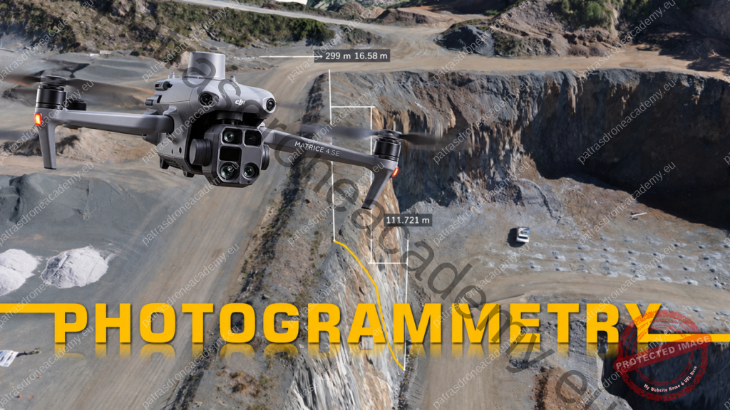
Until a few years ago, when we talked about drones, most of us thought of aerial photos and impressive videos. Today, however, their capabilities have advanced much further. One of their most interesting applications is drone photogrammetry, a technique that allows us to map areas, buildings, and other structures using photographs taken from the air.
Does that sound complicated? Actually, the basic idea is quite simple.
What is photogrammetry?
Let’s say we want to map a plot of land, a construction site, or a quarry.Instead of taking just one photo from above, we conduct a planned flight during which the drone photographs the area multiple times from different angles.These photos share a common feature: they overlap with one another.
In other words, the same point on the ground appears in more than one image. A specialized program then processes the photos, identifies common points, and calculates their position in space.This allows us to create a digital map or a 3D model of the area.
Simply put, we turn photos into useful information about the real world.
How is a photogrammetry flight conducted?
The process begins even before the drone takes off. First, the operator surveys the area and plans the flight. They determine the altitude, the route, the distance between flight lines, and the frequency of photo capture. The drone follows the planned route and captures the necessary images.Typically, the flight consists of a series of parallel paths over the area we want to capture.
Once data collection is complete, the photos are transferred to specialized software, where processing begins.This is where the most important part of the work takes place: the individual photos are combined to create a single image. Of course, the quality of this result depends on several factors, such as proper planning, the quality of the photos, weather conditions, and the required precision.
What can we create using photogrammetry?
Depending on the application, the data we collect can yield different results.
Orthophoto: This is a detailed aerial image of the area that has been geometrically corrected so that it can be used as a map.
3D Model: This allows us to view an area or a structure in three dimensions, rotate it on the screen, and examine details from different angles.
Digital Elevation Model: It captures the elevation differences in the area, including features such as buildings and vegetation.
Measuring Distances, Areas, and Volumes With proper data processing and sufficient data accuracy, we can perform calculations that are particularly useful in engineering projects and professional applications. For example, in a quarry, we can calculate the volume of a pile of materials or compare the condition of an area at different points in time.
Where is drone photogrammetry used?
Its applications are more numerous than one might imagine. In the construction industry, it is used to monitor construction sites and track the progress of work. In agriculture, it can help map farmland and better organize work. In quarries and mining sites, it allows for surveying the terrain and calculating material volumes. It is also used for surveying buildings, documenting historical monuments, and creating digital models of facilities. For engineers, surveyors, and other technical professionals, it serves as yet another tool for data collection and processing. This, of course, does not mean that a drone automatically replaces conventional surveying methods. When specific levels of accuracy are required, appropriate equipment, control points, precise measurements, and verification of the final result are necessary.
Is it enough to just know how to fly a drone?
This is perhaps the most significant difference between simple aerial photography and a photogrammetry mission.A pilot may know very well how to take off, fly, and land their drone. However, this does not necessarily mean they know how to organize a mapping mission.They must understand image overlap, camera requirements, flight planning, and the constraints that can affect the final result. It’s equally important to know what happens after the flight.Because in photogrammetry, taking the photos is only the first part of the process. The next step is to convert these images into data that can actually be put to use.
Photogrammetry as a Professional Skill
As drones are used in an increasing number of professional fields, interest in specialized knowledge is also growing. Photogrammetry is one such skill.
Photogrammetry Training from the Patras Drone Academy
At the Patras Drone Academy, we are organizing a specialized seminar on drone photogrammetry and 3D mapping, with the goal of helping participants learn both the theory and the practical application of this technology.The training program includes:
3 days of online theoretical training covering the basic principles of photogrammetry, mission planning, and data processing.
2 days of hands-on training, including actual mapping flights, photographing, and processing the results.
The class will have up to 15 participants to ensure there is sufficient time for hands-on practice. Our goal is for each trainee to understand the process from start to finish and gain meaningful initial experience in this specific field.
From Image to Information
Photogrammetry is a prime example of how the use of drones is evolving. We no longer fly just to view an area from above. We can collect data, study the area, and create digital outputs that have practical value.And this is perhaps the most interesting aspect of the technology: the ability to turn something as simple as a photograph into a useful tool.

